Posts

Showing posts from May, 2024

FISHERMANS BEND HISTORY

Image
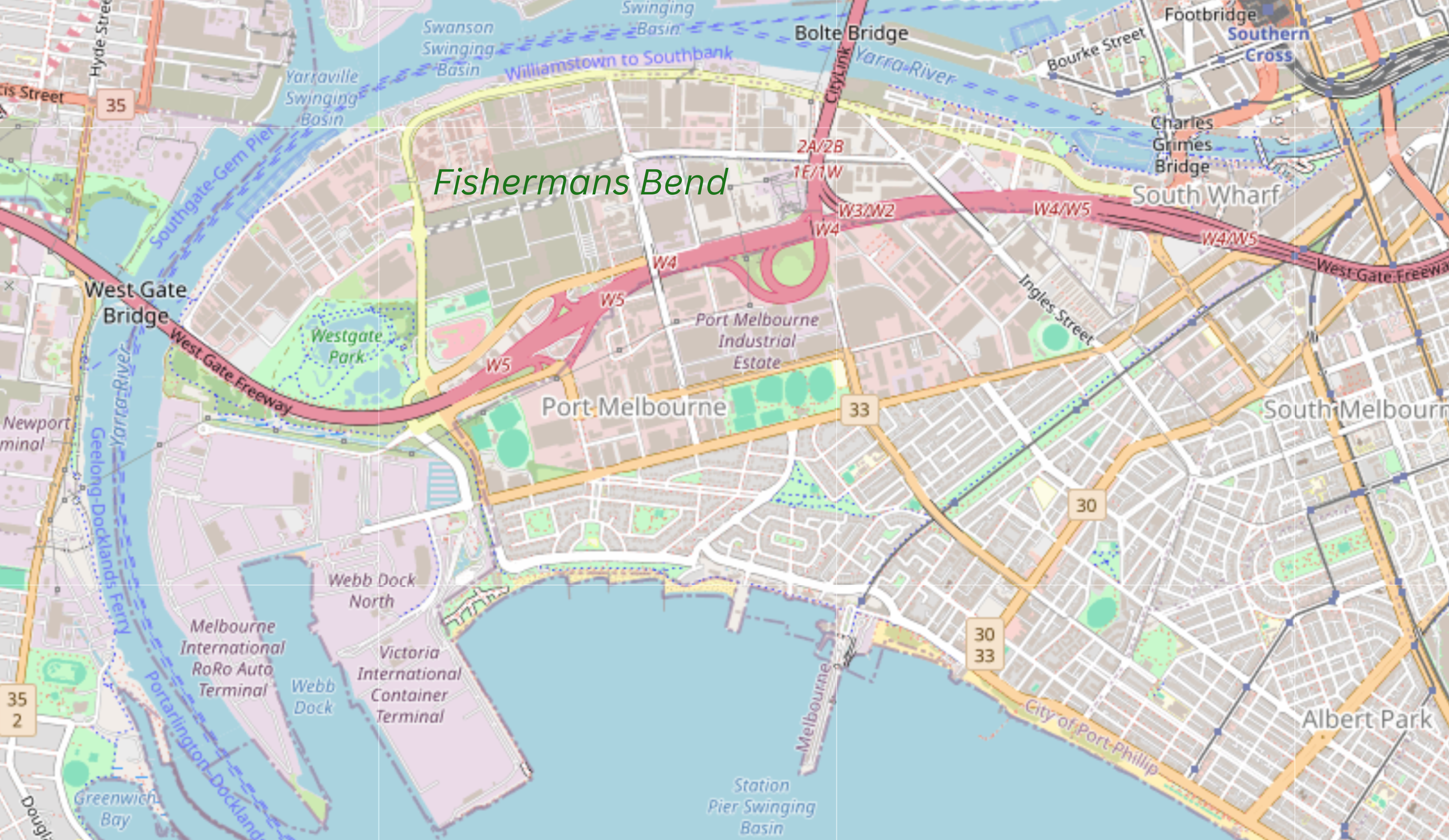
Fishermans Bend (formerly Fishermen's Bend)  is a precinct within the City of Port Phillip and the City of Melbourne. It is located on the south of the Yarra River in the suburb of Port Melbourne and opposite Coode Island, close to the Melbourne central business district. Fishermans Bend originally included the area now known as Garden City, which was renamed in 1929. Since 2012 the area has been designated as a major urban renewal area, with plans for 80,000 residents by 2050. The future framework for Fishermans Bend includes one major employment precinct and four primarily residential suburbs. Early Settlement Fishermen began settling 'Humbug Reach' and 'Fishermen's Bend' along the lower Yarra River in the 1850s. Thirty families lived on the 'Bend', frequently finding additional work in the docks and cargo ships and loading ballast for ships returning to Europe. Habitation was in rough shacks along the Bend, made from corrugated iron, flattened kerosen

Lerderderg River

Image
The Lerderderg River (known locally as The Lerdy) is a perennial river of the Port Phillip catchment, located in the Western District region of the Australian state of Victoria.   Location and features The Lerderderg River rises below the Blackwood Ranges, part of the Great Dividing Range, in the Lerderderg State Forest, near the locality of Blackwood. The river flows generally south by east in a highly meandering course, through the Lerderderg Gorge within the Wombat State Forest where it is joined by two minor tributaries, The Old River and Goodman Creek, before reaching its confluence with the Werribee River within the Melton Reservoir, southeast of Bacchus Marsh. The river descends approximately 383 metres (1,257 ft) over its 40 kilometres (25 mi) course. Diversion Tunnel Photo Andrew Parker The Lerderderg River diversion tunnel, also known as "The Tunnel," is a significant historical site located on the Lerderderg River, approximately 25 km northwest of Bacchus M